Learn & plan
Explore bait presentations, reading the water, knot tying, and tutorials. Review available water conditions and browse regional tournament listings.
 KayakFishingJournal.comCommunity driven fishing knowledge
For anglers. For rivers. For the stories.
A private fishing journal. A community of shared knowledge.
Log trips. Explore places. Learn. Connect.
Find your next event
FIND A TOURNEYChoose your state or region. Browse event listings and organizer schedules, then bring tournament details into your journal.
Explore available measurements and calculated fishing windows.
Skills. Techniques. Confidence.
80 anglers240 bait selections13 techniques
Our original bait survey · Angler-supplied selections and ChatGPT-derived technique analysis
Our foundation is the knowledge shared by 80 West Virginia kayak anglers, with a growing focus on surrounding regional waters.
Explore bait presentations, reading the water, knot tying, and tutorials. Review available water conditions and browse regional tournament listings.
Sign in with the same ChatGPT account on your phone and PC. Keep your trips, photos, equipment, teams, and sponsors together, and amend an existing report as you learn more.
Add up to five fish photos with optional lengths and bait used. Available photo GPS and timestamps stay in your journal unless you explicitly contribute the trip to WVKA research. Review total inches, average length, and incomplete records in your journal, printable report, and social text.
Compare waters, methods, seasons, and years. Explore reported fish per hour and which recorded baits were associated with larger measured fish. Your personal history stays private.
Compare your results with anonymous totals from other contributing anglers: reported catch rates, complete Best Five totals, and measured fish lengths by technique. Sharing is always your choice.
Choose Log this event or Compare event trips from the tournament calendar. Keep your self-reported placing and tournament score separate from our consistent Best Five journal comparison.
Add the fishing date, water, start and finish times, total catches, conditions, and what you tried. Enter zero when you caught no fish. Add your best fish photos, lengths and baits when available; leave unknown information blank.
As trips accumulate, use My fishing insights to compare your waters, methods, and year-by-year results. Explore baits & bigger bites groups your measured fish by the bait details you recorded. Fish per hour uses trips with both usable fishing times and catch counts.
Keep your journal private, preview a public story, or choose an optional research contribution. Data & sharing FAQ explains what each choice includes.
Filter shared trip totals by year, month, water type, reported species, methods, clarity, observed water temperature, or tournament event. Compare them with your own matching reports and decide what to explore on your next outing.
Record consistently. Community results require at least five eligible reports from three other signed-in anglers; your own contributions are excluded from the community side. Complete Best Five score averages require five measured fish per report. Partial records remain labeled, and official tournament scoring can use a different fish limit.
These are results from submitted trips, not the full tournament leaderboard or a prediction of your next catch. Water-type groups can span different locations, and methods or species filters describe whole trips. Best Five bait comparisons describe selected measured fish, not every fish caught. Trip length, conditions, reporting choices, and sample size all matter.
A slow trip is still an experience worth learning from. Fewer than five catches does not prove the wrong bait was used; missing measurements do not mean missing catches. Look for repeated patterns, ask better questions, and build your knowledge one trip at a time.
Learning grows through your own experiences—and through the collective knowledge anglers choose to share.
Jody Queen
“Wow. Extensive... Hits all the right frequently asked questions. Lots of information to be gathered and gained.”
Buddy Vance
“Program looks great and is easy to navigate. Tons of information.”
Tim Isaacs
“Looks extensive. I think people will benefit from this.”
Aaron Finney
“This App is a cheat sheet for any angler, basically adding years of knowledge you typically only get from time on the water. It also highlights the importance of kayak positioning. It’s what makes our sport different”
Rick Garavaglia
“This is Great! Accumulating that much information is amazing”.
READ THE RIVER BEFORE YOU LAUNCH
Choose the gauge on your river and reach. Nearby gauges can be on different streams.
Enter the station number from USGS Water Data. Gauge height is a reference level, not your local water depth.
Select a river gauge to begin.
━━ USGS measurements┄┄ NWS forecast
Forecasts cover the named gauge, not every launch or stretch. An unavailable forecast does not mean the river will stay unchanged.
Source: Open-Meteo weather-model estimates for one location, not measured rain or a watershed average. Upstream rain may reach your fishing area later. Check NWS observed rainfall and river information.
CONNECT THE NUMBERS TO YOUR NEXT CAST
Locate slower margins and current seams. Confirm kayak control before choosing a position.
Observe visibility at your reach. Gauge level and rainfall cannot tell you whether your water is clear or muddy.
Use the measured trend as context. Test bait speed and pause length, then let fish response guide adjustments.
ChatGPT-derived fishing interpretations: these are starting points to investigate, not verified fish locations, catch predictions, or advice supplied by the dataset’s anglers. Open a lesson to see the existing river graphic, positioning and presentation.
On regulated rivers, check the responsible dam operator as well as the gauge. A release schedule can change. These readings cannot establish safe paddling conditions for your reach.
USACE Huntington District water management · NWS river forecasts and flood information · NWS Charleston weather alerts
USGS readings may be provisional and revised. Each measurement has its own timestamp. Readings older than two hours are flagged; gaps and missing temperatures stay visible. The gauge directory covers the 26 states east of the Mississippi River, plus Texas. It was refreshed November 1, 2026 from USGS stream gauges with reported flow or level data, alongside existing stations; live availability varies. Town search, photo GPS and private trip reports work throughout this area. Gauge height is not river depth, and the same CFS can mean different conditions on different rivers.
Connect conditions with actual results. Entries are stored privately in the guide, accessed through a private key saved in this browser. They are not posted publicly or emailed as feedback. If you clear browser storage, you lose access to these notes; export a copy to keep them. Avoid including personal contact details.
PLAN YOUR TIME ON THE WATER
Choose a town or ZIP code near your fishing water.
Your location is used for this lookup, not added to WVKA visitor records. Searches and coordinates are sent to Open-Meteo to retrieve conditions. Saving is optional and stays on this device.
Search for a location to begin.
These are approximate solunar windows: major periods span one hour before and after the Moon crosses the local meridian; minor periods span 30 minutes before and after moonrise or moonset. Different apps may use different window lengths. These calculated times are planning references, not a catch prediction or an activity percentage.
Water temperature, current, clarity, forage and presentation still matter. Weather is a forecast for the selected location, not a measurement of river water temperature or safe river flow. Check local river gauges and conditions before launching.
Weather and place search: Open-Meteo. Sun and Moon calculations: SunCalc. Solunar reference: Florida Fish and Wildlife. These resources are separate from our angler-supplied bait dataset and ChatGPT technique analysis.
KAYAK FISHING JOURNAL · LEARN FROM THE WATER
Your collective knowledge. Your next cast.
Built from the experience of eighty anglers. Explore proven presentations, learn to read the current, and bring fresh ideas to your next trip and journal entry.
Angler lure data + ChatGPT technique analysis
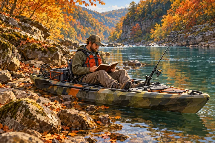
01 / THE RIVER LAB
An illustrative WV smallmouth river.
Flow moves left → right. Select a numbered fishing spot.
Learn a bottom bait, a moving bait, and a surface bait. This is a learning sequence, not a ranking of angler choices.
CHATGPT-DERIVED VISUAL TUTORIAL
Choose a technique to begin.
YOUR NEXT MOVE
Data and analysis: Anglers supplied the lure entries. Product photos show the labeled real lures. Rigging instructions, movements, cast plans, and kayak positions are ChatGPT-derived teaching examples, not demonstrations by those anglers or verified catch results.
CHECK YOUR UNDERSTANDING
This checks the teaching example, not a universal fishing rule.
Manufacturer references inform general lure and rig behavior. The river diagrams and recommended passes are ChatGPT-derived interpretations, not manufacturer-validated river plans.
Set up outside the fastest water.
02 / THE COLLECTIVE
One lesson per presentation, with a leading color family.
Explore individual angler choices in the source table.
COLOR & ANGLER CHOICES
Learn the presentation once. Color variations share one lesson. Anglers choose colors at their discretion and to “match the hatch”—the forage at their fishing location. The leading color family reflects selections, not catch rates or a universal recommendation.
Color counts use the workbook’s color families across all entries for that presentation. “Other / Unspecified” is excluded from named-color ranking; ties are shown. Real product photos identify the model and color shown. A representative photo may differ from an angler’s exact selection or the leading color family. Suggested rigs and retrieves are ChatGPT-derived.
Browse five presentation families below. These are teaching sections; the workbook’s original strategy classifications appear in the source overview.
WORKBOOK STRATEGY CLASSIFICATION
These strategy groups are derived classifications in the workbook, not techniques reported by each angler. Guide technique groups use lure categories and may have different totals.
| ANGLER | # | ANGLER-SUPPLIED LURE ENTRY |
|---|
Source: WV_Fall_Fishing_Master_80_With_Jared_Terry.xlsx. The Bait Selections and River Analysis tabs were checked on October 2, 2026: 80 distinct anglers, three selections each, 240 total, and matching lure entries across both tabs.
Habitat reference: WVDNR — Smallmouth Bass supports the general connection between smallmouth, rocks, eddies, runs, pools and forage. It does not validate the particular cast paths in this guide.
Map: Original illustrative river geometry; not a surveyed stretch of the New, Greenbrier, Gauley or any other river. No live gauges, depths, fish observations, or performance claims are implied.
KNOT TYING / TIE ON
Choose what you’re connecting, pick a knot, then follow one step at a time. Written steps work offline after the guide has been saved on this device.
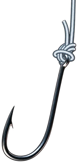
Follow the hands-on demonstration while practicing each step.
CHECK YOUR UNDERSTANDING
Choose an answer to compare it with this lesson.
Practice on a closed ring before handling a hooked lure. Moisten the line before drawing the knot tight, inspect the seated knot, and give the connection a controlled pull test. Retie damaged line or a poorly seated knot. Keep fingers clear of hooks and follow your line maker’s knot and trimming guidance.
Teaching library · Original summaries and checkpoints prepared with ChatGPT and checked against Berkley, Animated Knots and NetKnots. Each lesson links its tying reference. Favorites stay on this device. KFJ’s original animated step diagrams and written lessons are included in the app’s offline download. Publisher animations and videos need a connection.
Tell us what works—or join the WVKA river-guide update list. Both are optional.
WEST VIRGINIA & OUR NEIGHBORS
Browse live, in-person tournaments by month and day, then see the organization and fishing location. Filter by state to narrow your list.
Find event dates, eligible waters, rules and entry information on the organizer’s listing before registering.
TourneyX ↗Fishing Chaos ↗KBF regional championships ↗Schedule checked October 9, 2026. This is a partial schedule. Draft dates are labeled; more events can be added as schedules are published.
FROM COMMUNITY EXPERIENCE TO SHARED LEARNING
Good ideas start with time on the water. Explore the community’s favorite fall baits, then see what anglers are learning from shared New River trips.
Kayak Fishing Journal Community
Support the businesses that support our anglers.
West Virginia’s go-to source for all things kayak fishing. Bringing tournament news, angler profiles, industry updates, and fresh gear reviews, along with interviews with top local and national kayak anglers.
Support knowledge shared on the water.
Space availableConnect with our kayak angling community.
Space available